
 Artem Mikhailov (participant of New Year’s trip) gave me the idea of developing online maps of our itineraries. Regular maps for some routes have been around for a long time. But they lack interactivity and visibility. And with the help of the Google Maps service, you can attach photos and text with links to each point on the map. As a result, a curious tourist can imagine in advance what views await him at each stage of the trip. In addition, such cards look very stylish and modern. This alone can attract a certain class of customers.
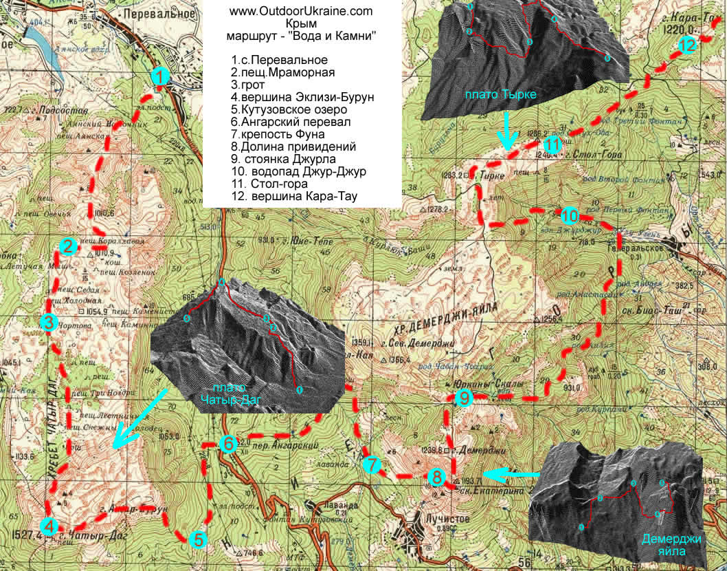
Another argument in favor of online maps is the speed of compilation. In my case, this is very important. The Orient Express route has existed for two years, but there was still no map for it – linking Photoshop with Ozick is so tedious and unproductive that I boldly put this matter on the back burner. Now everything will be different. Stopudovo :)
It all sounds very tempting, but until the final victory is still to plow and plow. At the moment I’m picking illustrations for English map of the jeep version of the Water and Stones route.